The Wave & Vermillion Cliffs Adventure
Share


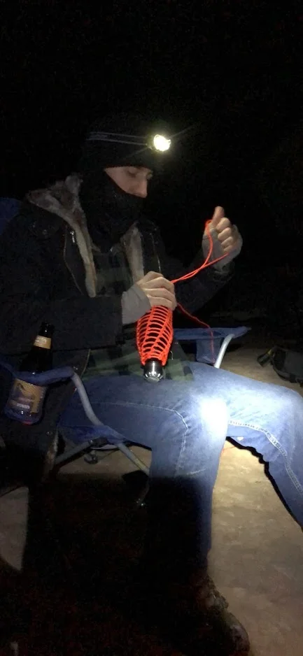
Chan & I then made the long drive out to White Pocket which would be our home for the night. White Pocket is a playground of its own filled with crazy sandstone formations. I played around with some astro photography until my brain decided to start thinking about skinwalkers. I noped back to camp from the moonless ice cream swirlscape that White Pocket was that evening. Honestly the place is a little creepy when its pitch black out. Oh yeah, Chandler made a paracord net for his water bottle that came in handy later.


In the morning I made us my classic camping breakfast of bacon and egg filled hashbrowns before cleaning and packing up camp and heading out to coyote buttes south. I had checked the weather with the magical phone signal that was spottily appearing all over the Vermillion Cliffs area and it didn’t look the best for Saturday. Sunday’s forecast was starting to look a little more optimistic. We took our time leaving because I thought there would be plenty of downtime today. I had expected the area to be similar in size to White Pocket. This assumption turned out to be very very wrong.

Chan & I arrived at the trailhead for where we would end up spending the rest of our sunlight and set out across the sandy landscape. Just as we had arrived a photographer and a different photography workshop seemed to be finishing up and were headed out as we geared up for our hike. With only one car besides ours remaining in the parking area it seemed we would have the whole area almost to ourselves. The sky looked like rain was in our future but it never rained more than a light drizzle which was completely manageable with my disposable rain poncho, and Chan’s invisibility cloak. Like I had mentioned before I had expected something similar to White Pocket and was blown away by the amount of pastel colors embedded in the rock here; much cooler! The area is full of sandstone fins as thin as paper, hoodoos with crazy tight layering, wave like formations and more. We explored from one saved GPS marker to another until we ran out of light.

We navigated out of the area in the fading light and made our way to the Stateline Campground where we made camp in the rain. Typically I avoid developed campsites but this one was particularly close to where we would begin our morning hike to The Wave so I conceded. The road wasn’t too wet on our way to camp so we hoped it wouldn’t be bad in the morning. The main road for the area had many spots where the clay turned to mush in the moisture so we had been pretty lucky so far that the rain hadn’t soaked it.

At camp we boiled up some water for some cookies and creme hot not-chocolate as well as for our dinners while Chan proceeded to burn literally all the firewood almost at once. It was spectacular. We then crawled into our tents and I fell asleep to the patter of rain on the canvas. At about 4 AM intense (in-tents get it? 🙃) wind and rain woke me. I laid there staring at the ceiling and worrying about the road for about an hour before finally getting up. The rain eventually relented as we cooked more eggy-hash and a whole package of bacon before packing up camp and heading on our way to Wire Pass.
The road while muddy wasn’t really much of a problem for the Avalanche so we got to the trailhead in no time. The route to The Wave isn’t much of a trail so finding your way is a lot more fun than normal hiking in my opinion. Along the way we saw a small herd of bighorn sheep which was a special treat in addition to the spectacular sights that were to come!

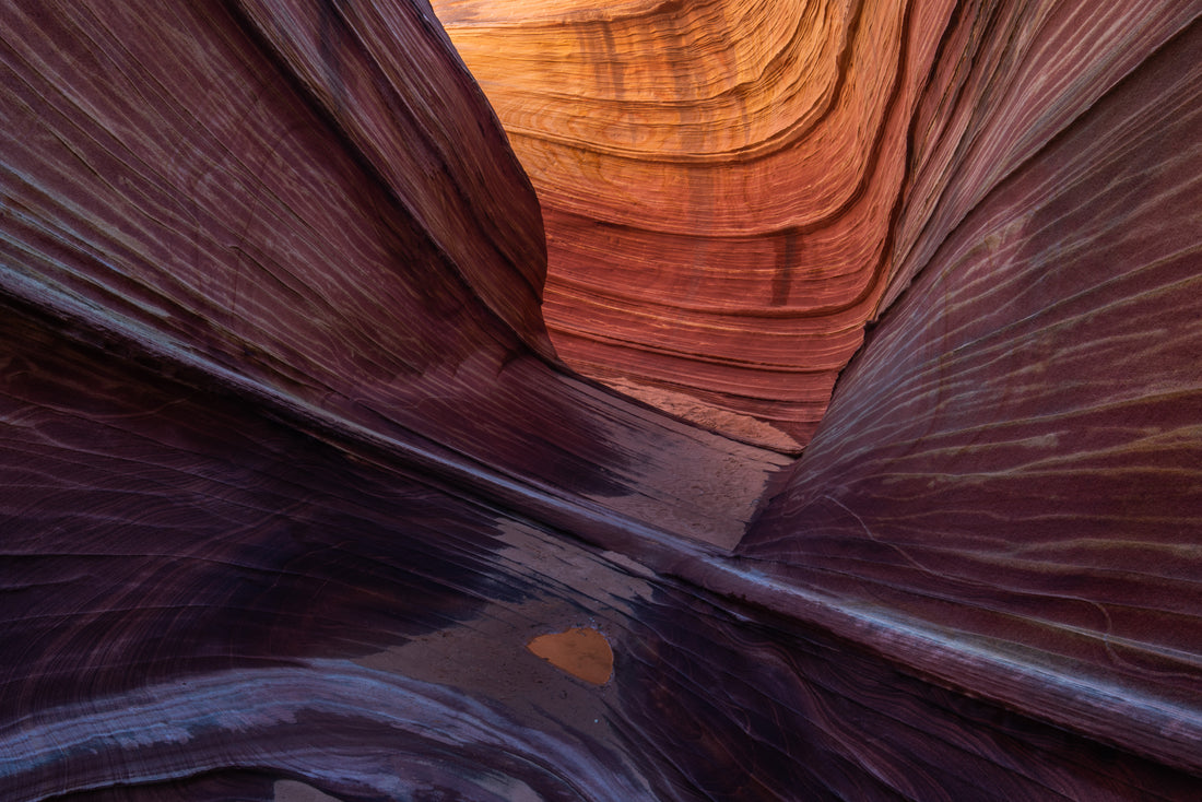
Once we got to The Wave itself we chilled there for a bit and enjoyed some leftover bacon from breakfast as we stared at the spectacular bacon rock that was in front of us. It was a this point that the unrelenting wind was beginning to be a nuisance. While at The Wave I took the most difficult photo I have ever taken. I had climbed up above The Wave itself and was trying to take a photo straight down into the formation but the wind kept trying to unseat me from my precarious position where if I fell it would not be good news. With some help from Chan’s conveniently netted water bottle weighing down my tripod I eventually I bagged the shot and we kept on exploring.


Chan and I proceeded to explore the nearby area seeing pools of water, more crazy wave like formations, crazy fin rocks, dinosaur tracks, a slot canyon we had to find our way out of, and then we found ourselves back at The Wave and decided where to go from there. Where we went wasn’t so smart.

About 500-800ish feet above The Wave you can see an arch overlooking the spectacular scenery, so obviously we wanted to go see it up close. Naturally Chan and I tried to follow the closest route we could find on my topo map and we turned ourselves into mountain goats climbing a steep slick-rock ridge. As we climbed up we were less and less sure of our route and felt increasingly unsafe. I urged us onward until we reached the top to find that there was a cliff between us and the arch.

It was at this point that we were slammed by an intense wind that didn’t dare fight so we both dropped to the ground before it could send us tumbling to our deaths. So after wasting about 45-60 minutes of our precious time here we “mountain-goated” our way back down and went the route that my researched info showed me and found our way to the top of the sandstone ridge. We never did find our way to that specific arch. We did however find the Alcove, a Wave overlook, Moki Marbles, Crazy formations, and Melody Arch- the grotto which was just spectacular!


At this point the sun was set and we donned our headlamps and scrambled back down the sandy landscape. Chan and I were pretty confident about finding out way back in the dark since we had GPS help and we were generally pretty good at finding our way around. That’s why I am severely disappointed in myself that we got a little lost in the pitch darkness. We ended up noticing the silhouettes of sandstone tepees that didn’t match memory and eventually found ourselves cliffed out, forcing us to turn around and figure out where we were. We somehow ended up losing our bearings and were going West instead of North. After some star, gps, and compass navigation we found our way back to the original route and got to the truck, ready for some food and sleep. We planned to drive home this evening and get some food along the way. We probably were not going to make it home until pretty early in the morning which is why our next discovery was pretty devastating. About 2.5 miles from the highway that would lead us home we came across this:

The road was completely washed out. The craziest thing is that it hadn’t rained anywhere nearby since early in the morning. Later research shows that buskin gulch has a HUGE drainage area so it was probably storming around 50 miles away somewhere.
I stood on the bank of the newly formed river contemplating crossing in the Avalanche until I saw some water churn more and more of the underlying ground away. Trying to cross this was a bad idea and there was another option it just wasn’t my favorite. To get home we drove south into Arizona and back up north adding about 2 hours to our journey. We made a stop at a Denny’s for some much needed food and caffeine and proceeded home. Chan drove the first leg of our journey while I took a few hour nap and then he pulled over in the middle of nowhere where we could trade off. There just happened to be some bones on the side of the road where we stopped. Must have been skinwalkers I guess.
Overall the trip was 100% worth the hassle and I would do it all over again if it meant visiting these special places. It truly is a bucket list destination, and I already want to go back.
